
Mapping bathymetry and shallow water benthic habitats in inland and coastal waters with Sentinel-2
All claims expressed in this article are solely those of the authors and do not necessarily represent those of their affiliated organizations, or those of the publisher, the editors and the reviewers. Any product that may be evaluated in this article or claim that may be made by its manufacturer is not guaranteed or endorsed by the publisher.
Published: 15 March 2023
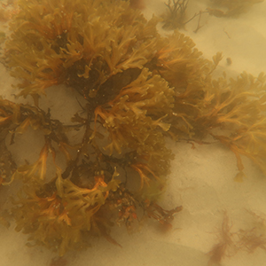
Accurate determination of the water depth and benthic macroalgae composition in coastal and inland water bodies is important due to the high commercial and ecological value of these regions. Benthic habitat mapping by conventional methods provides good accuracy, but these methods are very expensive and limited by manpower and time factor, which is necessary for mapping large areas. Remote sensing methods significantly complement contact measurements and give additional information about the hard-to-reach areas. The usefulness of free Sentinel-2 data in bathymetry and habitat mapping has been demonstrated in clear oceanic waters. The aim of this study was to further test the suitability of Sentinel-2 imagery in creating maps of dominant benthic types, as well as in estimating bathymetry in optically complex marine and lake waters. Two study sites were selected to cover a representative range of optical variability - Lake Garda in northern Italy (an intermediate between clear ocean and optically very complex waters) and Viimsi peninsula on the Estonian side of the Gulf of Finland, in the Baltic Sea. The results show that Sentinel-2 imagery with 10 m spatial resolution is suitable for bathymetry and habitat mapping in optically complex inland and coastal waters. Our results show that bathymetry mapping is sufficiently accurate in waters less than 4 m deep in the case of the Baltic Sea and up to 7 m deep in Lake Garda. In such depths, the R2 was above 0.93 in all four Sentinel-2 images used in the study. Bottom type mapping accuracy was in all cases over 73%, which is considered to be good, but due to the limited number of sampling points in both test sites, further studies are needed. The Sentinel-2 data quality and no cost of the imagery for users make it very useful for mapping bathymetry and shallow water habitats over large coastal areas or high number of lakes, especially in hard to reach by in situ methods areas. Moreover, the frequent revisit time allows moving from one-off maps to monitoring of temporal changes happening in dynamic shallow inland and coastal waters.
Downloads
Antoine D, Morel A, 1999. A multiple scattering algorithm for atmospheric correction of remotely sensed ocean colour (MERIS instrument): principle and implementation for atmospheres carrying various aerosols including absorbing ones. Int. J. Remote Sens. 20:1875-1916. DOI: https://doi.org/10.1080/014311699212533
Barale V, Folving S, 1996. Remote sensing of coastal interactions in the Mediterranean region. Ocean Coast Manag. 30:217-233. DOI: https://doi.org/10.1016/0964-5691(95)00059-3
Bramante JF, Raju DK, Sin TM, 2013. Multispectral derivation of bathymetry in Singapore’s shallow, turbid waters. Int. J. Remote Sens. 34:2070-2088. DOI: https://doi.org/10.1080/01431161.2012.734934
Caballero I, Stumpf RP, Meredith A, 2019. Preliminary assessment of turbidity and chlorophyll impact on bathymetry derived from Sentinel-2A and Sentinel-3A satellites in South Florida. Remote Sens. 11:645. DOI: https://doi.org/10.3390/rs11060645
Caballero I, Stumpf RP, 2019. Retrieval of nearshore bathymetry from Sentinel-2A and 2B satellites in South Florida coastal waters. Estuar. Coast. Shelf Sci. 226:106277. DOI: https://doi.org/10.1016/j.ecss.2019.106277
Casal G, Hedley JD, Monteys X, Harris P, Cahalane C, McCarthy T, 2020. Satellite-derived bathymetry in optically complex waters using a model inversion approach and Sentinel-2 data. Estuar. Coast. Shelf Sci. 241:106814. DOI: https://doi.org/10.1016/j.ecss.2020.106814
Congalton RG, 1991. A review of assessing the accuracy of classifications of remotely sensed data. Remote Sens. Environ. 37:35-46. DOI: https://doi.org/10.1016/0034-4257(91)90048-B
Davies‐Colley RJ, Vant WN, 1987. Absorption of light by yellow substance in freshwater lakes. Limnol. Oceanogr. 32:416-425. DOI: https://doi.org/10.4319/lo.1987.32.2.0416
Dekker AG, Brando VE, Anstee JM, Pinnel N, Kutser T, Hoogenboom J, et al., 2001. Imaging spectrometry of water, p. 307-359. In: FD van der Meer and SM De Jong (eds.), Imaging spectrometry: Basic principles and prospective applications. Springer, Dordrecht. DOI: https://doi.org/10.1007/978-0-306-47578-8_11
Dekker AG, Phinn SR, Anstee J, Bissett P, Brando VE, Casey B, et al., 2011. Intercomparison of shallow water bathymetry, hydro‐optics, and benthos mapping techniques in Australian and Caribbean coastal environments. Limnol. Oceanogr-Meth. 9:396-425. DOI: https://doi.org/10.4319/lom.2011.9.396
Dennison WC, 1987. Effects of light on seagrass photosynthesis, growth and depth distribution. Aquat. Bot. 27:15-26. DOI: https://doi.org/10.1016/0304-3770(87)90083-0
Dennison WC, Orth RJ, Moore KA, Stevenson JC, Carter V, Kollar S, et al., 1993. Assessing water quality with submersed aquatic vegetation. BioScience 43:86-94. DOI: https://doi.org/10.2307/1311969
Dörnhöfer, K, Göritz, A, Gege, P, Pflug, B, Oppelt, N, 2016. Water constituents and water depth retrieval from Sentinel-2A - A first evaluation in an oligotrophic lake. Remote Sens. 8:941. DOI: https://doi.org/10.3390/rs8110941
Dutkiewicz S, Hickman AE, Jahn O, Henson S, Beaulieu C, Monier E, 2019. Ocean colour signature of climate change. Nat. Commun. 10:1-13. DOI: https://doi.org/10.1038/s41467-019-08457-x
Emde C, Barlakas V, Cornet C, Evans F, Korkin S, Ota Y, et al., 2015. IPRT polarized radiative transfer model intercomparison project - Phase A. J. Quant. Spectrosc. Radiat. Transf. 164:8-36. DOI: https://doi.org/10.1016/j.jqsrt.2015.05.007
EPA (Environmental Protection Agency), 1993. ESS Method 340.2: Total suspended solids, mass balance (dried at 103-105ºC) volatile suspended solids (ignited at 550ºC). Environmental Sciences Section, Wisconsin State Lab of Hygiene, Madison.
Fonseca MS, 1989. Sediment stabilization by Halophila decipiens in comparison to other seagrasses. Estuar. Coast. Shelf Sci. 29:501-507. DOI: https://doi.org/10.1016/0272-7714(89)90083-8
Francour P, 1997. Fish assemblages of Posidonia oceanica beds at Port‐Cros (France, NW Mediterranean): assessment of composition and long‐term fluctuations by visual census. Mar. Ecol. 18:157-173. DOI: https://doi.org/10.1111/j.1439-0485.1997.tb00434.x
Fritz C, Kuhwald K, Schneider T, Geist J, Oppelt N, 2019. Sentinel-2 for mapping the spatio-temporal development of submerged aquatic vegetation at Lake Starnberg (Germany). J. Limnol. 78:1824. DOI: https://doi.org/10.4081/jlimnol.2019.1824
Fyfe SK, 2003. Spatial and temporal variation in spectral reflectance: Are seagrass species spectrally distinct? Limnol. Oceanogr. 48:464-479. DOI: https://doi.org/10.4319/lo.2003.48.1_part_2.0464
Lõugas L, Kutser T, Kotta J, Vahtmäe E, 2020. Detecting long time changes in benthic macroalgal cover using landsat image archive. Remote Sens. 12:1901. DOI: https://doi.org/10.3390/rs12111901
Ghirardi N, Bolpagni R, Bresciani M, Valerio G, Pilotti M, Giardino C, 2019.Spatiotemporal dynamics of submerged aquatic vegetation in a deep lake from Sentinel-2 data. Water 11:563. DOI: https://doi.org/10.3390/w11030563
Goodman JA, Lee Z, Ustin SL, 2008. Influence of atmospheric and sea-surface corrections on retrieval of bottom depth and reflectance using a semi-analytical model: a case study in Kaneohe Bay, Hawaii. Appl. Opt. 47:F1-F11. DOI: https://doi.org/10.1364/AO.47.0000F1
Halpern BS, Walbridge S, Selkoe KA, Kappel CV, Micheli F, D'Agrosa C, Watson R, 2008. A global map of human impact on marine ecosystems. Science 319:948-952. DOI: https://doi.org/10.1126/science.1149345
Hedley JD, Harborne AR, Mumby PJ, 2005. Simple and robust removal of sun glint for mapping shallow‐water benthos. Int. J. Remote Sens. 26:2107-2112. DOI: https://doi.org/10.1080/01431160500034086
Hedley JD, Roelfsema C, Brando V, Giardino C, Kutser T, Phinn S, et al., 2018. Coral reef applications of Sentinel-2: Coverage, characteristics, bathymetry and benthic mapping with comparison to Landsat 8. Remote Sens. Environ. 216:598-614. DOI: https://doi.org/10.1016/j.rse.2018.07.014
Hedley JD, Roelfsema C, Koetz B, Phinn S, 2012. Capability of the Sentinel 2 mission for tropical coral reef mapping and coral bleaching detection. Remote Sens. Environ. 120:145-155. DOI: https://doi.org/10.1016/j.rse.2011.06.028
Hedley JD, Roelfsema C, Phinn SR, 2009. Efficient radiative transfer model inversion for remote sensing applications. Remote Sens. Environ. 113:2527-2532. DOI: https://doi.org/10.1016/j.rse.2009.07.008
Hemminga MA, Duarte CM, 2000. Seagrass ecology. Cambridge University Press, Cambridge: 298 pp. DOI: https://doi.org/10.1017/CBO9780511525551
Jeffrey ST, Humphrey GF, 1975 New spectrophotometric equations for determining chlorophylls a, b, c1 and c2 in higher plants, algae and natural phytoplankton. Biochem. Physiol. Pflanz. 167:191-194. DOI: https://doi.org/10.1016/S0015-3796(17)30778-3
Kay S, Hedley JD, Lavender S, 2009. Sun glint correction of high and low spatial resolution images of aquatic scenes: a review of methods for visible and near-infrared wavelengths. Remote Sens. 1:697-730. DOI: https://doi.org/10.3390/rs1040697
Knudby A, Newman C, Shaghude Y, Muhando C, 2010.Simple and effective monitoring of historic changes in nearshore environments using the free archive of Landsat imagery. Int. J. Appl. Earth Obs. Geoinf. 12:116-S122. DOI: https://doi.org/10.1016/j.jag.2009.09.002
Kotta J, Remm K, Vahtmäe E, Kutser T, Orav-Kotta H, 2014. In-air spectral signatures of the Baltic Sea macrophytes and their statistical separability. J. Appl. Remote Sens. 8:083634. DOI: https://doi.org/10.1117/1.JRS.8.083634
Kuhwald K, Schneider von Deimling J, Schubert P, Oppelt N, 2022. How can Sentinel-2 contribute to seagrass mapping in shallow, turbid Baltic Sea waters? Remote Sens. Ecol. Conserv. 8:263-425. DOI: https://doi.org/10.1002/rse2.246
Kutser T, Dekker AG, Skirving W, 2003. Modelling spectral discrimination of Great Barrier Reef benthic communities by remote sensing instruments. Limnol. Oceanogr. 48:497-510. DOI: https://doi.org/10.4319/lo.2003.48.1_part_2.0497
Kutser T, Hedley JD, Giardino C, Roelfsema C, Brando VE, 2020. Remote sensing of shallow waters–A 50-year retrospective and future directions. Remote Sens. Environ. 240:111619. DOI: https://doi.org/10.1016/j.rse.2019.111619
Kutser T, Jupp DLB, 2002. Mapping coral reef benthic habitat with a hyperspectral space borne sensor, p. 18-22. Proceedings Ocean Optics Conference XVI.
Kutser T, Miller I, Jupp DL, 2006. Mapping coral reef benthic substrates using hyperspectral space-borne images and spectral libraries. Estuar. Coast. Shelf Sci. 70:449-460. DOI: https://doi.org/10.1016/j.ecss.2006.06.026
Kutser T, Vahtmäe E, Martin G, 2006a. Assessing suitability of multispectral satellites for mapping benthic macroalgal cover in turbid coastal waters by means of model simulations. Estuar. Coast. Shelf Sci. 67:521-529. DOI: https://doi.org/10.1016/j.ecss.2005.12.004
Kutser T, Vahtmäe E, Metsamaa L, 2006b. Spectral library of macroalgae and benthic substrates in Estonian coastal waters. Proc. Estonian Acad. Sci. Biol. Ecol. 55:329-340. DOI: https://doi.org/10.3176/biol.ecol.2006.4.05
Lafon V, Froidefond JM, Lahet F, Castaing P, 2002. SPOT shallow water bathymetry of a moderately turbid tidal inlet based on field measurements. Remote Sens. Environ. 81:136-148. DOI: https://doi.org/10.1016/S0034-4257(01)00340-6
Lee Z, Carder KL, Chen RF, Peacock TG, 2001. Properties of the water column and bottom derived from airborne visible infrared imaging spectrometer (AVIRIS) data. J. Geophys. Res. Oceans. 106:11639-11651. DOI: https://doi.org/10.1029/2000JC000554
Lee Z, Carder KL, Mobley CD, Steward RG, Patch JS, 1998. Hyperspectral remote sensing for shallow waters. I. A semianalytical model. Appl. Opt. 37:6329-6338. DOI: https://doi.org/10.1364/AO.37.006329
Lee Z, Carder KL, Mobley CD, Steward RG, Patch JS, 1999. Hyperspectral remote sensing for shallow waters: 2. Deriving bottom depths and water properties by optimization. Appl. Opt. 38:3831-3843. DOI: https://doi.org/10.1364/AO.38.003831
Leira M, Cantonati M, 2008. Effects of water-level fluctuations on lakes: an annotated bibliography. Hydrobiologia 613:171-184. DOI: https://doi.org/10.1007/s10750-008-9465-2
Möller T, Kotta J, Martin G, 2009. Effect of observation method on the perception of community structure and water quality in a brackish water ecosystem. Mar. Ecol. 30:105-112. DOI: https://doi.org/10.1111/j.1439-0485.2009.00325.x
Morel A, Claustre H, Gentili B, 2010. The most oligotrophic subtropical zones of the global ocean: similarities and differences in terms of chlorophyll and yellow substance. Biogeosciences 7:3139-3151. DOI: https://doi.org/10.5194/bg-7-3139-2010
Mumby PJ, Edward, AJ, 2002. Mapping marine environments with IKONOS imagery: enhanced spatial resolution can deliver greater thematic accuracy. Remote Sens. Environ. 82:248-257. DOI: https://doi.org/10.1016/S0034-4257(02)00041-X
Pearson TA, 1978. Macrobenthic succession in relation to organic enrichment and pollution of the marine environment. Oceanogr. Mar. Biol. Ann. Rev. 16:229-311.
Phinn SR, Dekker AG, Brando VE, Roelfsema CM, 2005. Mapping water quality and substrate cover in optically complex coastal and reef waters: an integrated approach. Mar. Pollut. Bull. 51:459-469. DOI: https://doi.org/10.1016/j.marpolbul.2004.10.031
Salmaso N, Boscaini A, Capelli C, Cerasino L, 2018. Ongoing ecological shifts in a large lake are driven by climate change and eutrophication: evidences from a three-decade study in Lake Garda. Hydrobiologia 824:177-195. DOI: https://doi.org/10.1007/s10750-017-3402-1
Schramm W, 1996. Marine benthic vegetation: recent changes and the effects of eutrophication. Springer, Dordrecht: 473 pp. DOI: https://doi.org/10.1007/978-3-642-61398-2
Traganos D, Reinartz P, 2018. Mapping Mediterranean seagrasses with Sentinel-2 imagery. Mar. Pollut. Bull. 134:197-209. DOI: https://doi.org/10.1016/j.marpolbul.2017.06.075
Uusõue M, Ligi M, Kutser T, Bourrin F, Uudeberg K, Kangro K, Paavel B, 2022. Effects of weather conditions on particle dynamics and properties in West-Estonian coastal areas. Oceanologia 64:694-716. DOI: https://doi.org/10.1016/j.oceano.2022.06.006
Vahtmäe E, Kutser T, 2013. Classifying the Baltic Sea shallow water habitats using image-based and spectral library methods. Remote Sens. 5:2451-2474. DOI: https://doi.org/10.3390/rs5052451
Vahtmäe E, Kutser T, Martin G, Kotta J, 2006. Feasibility of hyperspectral remote sensing for mapping benthic macroalgal cover in turbid coastal waters - a Baltic Sea case study. Remote Sens. Environ. 101:342-351. DOI: https://doi.org/10.1016/j.rse.2006.01.009
Werdell PJ, Roesler CS, 2003 Remote assessment of benthic substrate composition in shallow waters using multispectral reflectance. Limnol. Oceanogr. 48:557-567. DOI: https://doi.org/10.4319/lo.2003.48.1_part_2.0557
Wilson KL, Wong MC, Devred E, 2020. Branching algorithm to identify bottom habitat in the optically complex coastal waters of Atlantic Canada using Sentinel-2 satellite imagery. Front. Environ. Sci. 8:579856. DOI: https://doi.org/10.3389/fenvs.2020.579856
Yunus AP, Dou J, Song X, Avta, R, 2019. Improved bathymetric mapping of coastal and lake environments using Sentinel-2 and Landsat-8 images. Sensors 19:2788. DOI: https://doi.org/10.3390/s19122788
Edited by
Supporting Agencies
How to Cite

This work is licensed under a Creative Commons Attribution-NonCommercial 4.0 International License.