Using remote sensing and numerical modelling to quantify a turbidity discharge event in Lake Garda

All claims expressed in this article are solely those of the authors and do not necessarily represent those of their affiliated organizations, or those of the publisher, the editors and the reviewers. Any product that may be evaluated in this article or claim that may be made by its manufacturer is not guaranteed or endorsed by the publisher.
Authors
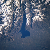
We investigate the effect of the Adige-Garda spillway opening on the 03/03/2020 on Lake Garda using numerical modelling and maps of Suspended Particulate Matter (SPM) concentration. SPM maps are obtained from Sentinel-2 images processed using the BOMBER bio-optical model. Three satellite images are examined: 28/02/2020, 04/03/2020 and 07/03/2020. Maps indicate a significant increase in SPM concentrations, especially in the northern part of the lake close to the hydraulic tunnel outlet. Results are consistent with the modelled flow field. Remote sensing effectively captures the event’s spatial and temporal variation, while numerical modelling explains and corroborates the observed patterns.
Edited by
Diego Fontaneto, CNR IRSA, Verbania, ItalyDepartment of Civil, Environmental and Mechanical Engineering (DICAM), University of Trento
How to Cite

This work is licensed under a Creative Commons Attribution-NonCommercial 4.0 International License.


